Dursley Figure of Eight
summary
Complete the full figure of eight in one go, starting and finishing at the Market Place.
A wide loop, west, around the town through fields, woods, and a golf course. Back around the Uley Valley taking in the fields and woods on to Owlpen Manor, and returning over Uley Bury and Cam Peak.
A wide loop, west, around the town through fields, woods, and a golf course. Back around the Uley Valley taking in the fields and woods on to Owlpen Manor, and returning over Uley Bury and Cam Peak.
Details and start point
Distance: 16 miles
Distance: 26 km
Walking time: 9 hours
Grid Reference: ST756981
What 3 Words: rift.loudness.stags
Share this walk with your friends:
Print Walk
Step by Step Directions
1
Go down Silver Street and turn first right up Boulton Lane. At the top of the road continue ahead up the bridleway and into the wood.Go up next to the fence on the left but when it turns down left you go up ahead on a broad path. Reach a more open and almost level area where several paths converge around a clump of trees.
Turn right, pass the first narrow downhill path, and take the next one, which is broader and more level. Avoid the right-hand fork and continue, with a field on the left.
Where the field ends continue straight on. There are some narrow stretches which can be very muddy, but do not deviate from this path, which becomes wider again.
At the road go left up the hill, then right and, almost immediately, left.
2
The walk will now follow the perimeter of Stinchcombe Hill Golf Course for 1.5 miles, with woods on your left and the course on your right.At the end of the tarmac go right alongside the trees, passing the Cotswold Way fingerpost. After the car park go left along the edge.
After going through a corner of the wood you will emerge with a panoramic view in front of you.
Turn right to follow the obvious narrow path and, ignoring the Cotswold Way which turns up right, continue on this line. You come to a fork at some trees.
Go ahead around the headland and up sharp right to a bench.
Now walk with the bench behind you, and pass, in succession, a stone memorial bench, Cotswold Way fingerpost, trig point, topograph and way-marker, still with woods on left and golf course on right.
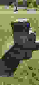
Come to a stone shelter. You can pass behind or in front of this, then follow Cotswold Way signs until you come to a stony track beside which is a mounting stone where riders would remount their horses after leading them up the track you will now descend, on your left.
3
This track, which is rough and can be muddy, leads down to a road. Once there turn left and cross carefully where the pavement ends before the bend.After the lane signposted to Stinchcombe are the gates to Piers Court. Go through the pedestrian gate and walk along the drive, over the cattle grid, and just after the low stone wall on your left ends, turn right across the grass slope towards a stile.
After the stile, go straight down through two fields into the churchyard. If you are not visiting the church, go down through the churchyard, left of the church, and turn right onto Wick Lane up to the road junction.
4
Turn left and walk down Echo Lane for 80 yards and then turn right through the gap in the wall to head for a stile and gate and go up the field beyond.The route is now more or less straight ahead, parallel to the motorway, over five stiles to a main road.
At the road go up right and cross carefully to a metal gate and stile by a fingerpost. This leads to a track. Go down the track, through a kissing gate, then slightly right across the next field to a stile.
Now go directly up to a kissing gate, then a stile. The path bends around some trees on your left, then past a sheet metal gate in a conifer hedge, to reach a road.
5
Across the road follow the field edge for 40 yards then turn left to follow a path between fences to a kissing gate.Go ahead down the field, through the kissing gate, to a road (Spark Hill). Go down left, then turn right and cross the road to descend a short path leading to another road.
Turn right and follow this road as it bends left down to a main road. Here turn right and cross at the pedestrian crossing to go straight ahead by the fingerpost pointing to Upthorpe.
6
The route goes straight through Rackleaze Nature Reserve, crossing the River Cam and exiting at a stile.Take the obvious path slightly left to a stile and continue ahead to a larger opening. Here you turn right up to a steel gate. Carry on through five more gates to a road. This is Upthorpe.
7
Turn right and after 50 yards, opposite Upper Upthorpe Farm, turn left up the wooden steps between houses, leading into a field which you cross to a gate.Turn right, cross the stile and go half left, first towards the obvious large trees, then make for the field gate. Once through the gate bear slightly left to the first of two stiles that take you across the corner of a field.
Go ahead down the next field, aiming left of the line of telegraph poles, to find, in the bushes, some steps leading down to a footbridge over Delkin Brook.
When you emerge from this little cutting follow the obvious way ahead across two fields to a kissing gate beside a house leading to a road.
8
Cross the road and go right to enter the churchyard via the gate in the wall. On your right you will see a former National School building.Keeping the Church on your left, follow the path around, passing to the left of a large oak tree.
Exit along the drive and cross the road to the footpath at the Dursley fingerpost.
Keep the houses on your right until you turn left over the wooden bridge after the play area. At the road turn right and cross by the Vale Hospital.
At the road junction go up left, then immediately left again to take the footpath. Follow this as it leads up-hill to a gate onto a road.
Go along the road and after the junction of The Knapp, enter Dursley Recreation Ground through a pedestrian gate on the left.
Continue ahead to Dursley centre. The exit gate is at the right-hand end of the swimming pool in front of you. Go down the side of the swimming pool and through the car park to the road.
To return to the Market Place you can go down this road past Sainsbury’s or cross into the pedestrianised town centre and turn left.
9
Carefully cross the road to enter the church yard through the commemorative iron gate and then follow the path to the right of the church and exit ahead down some steps to Broadwell.Ignore the footpath sign on the arch and instead cross the stream and go left to follow the water side down Water Street. Where this meets another road turn right and after 70 yards, turn left along Brownings Lane and then continue ahead on the stream-side path.
When this meets another path just beyond some bollards, go slightly right to cross the wide sweep of the road and turn left by Erwell House onto another stream side path.
After running alongside open space behind modern housing, the path bears to the right away from the stream to reach Uley Road.

10
Here turn left on the roadside path and after 20 yards, carefully cross the road to a flight of steps leading up to an old mill pond in another open space amongst housing.Pass the mill pond on either side and continue straight ahead on Caswell Mews to a park entrance. Turn immediately left over a stile and follow the path as it sweeps up and around to the right beside the trees to a kissing gate.
Then follow the path that leads slightly left into a wood. Go through the wood and then continue along a broad path to another kissing gate.
11
Through the gate, turn left to follow the path across two fields and then diagonally cross the field at the rear of the farm buildings to a kissing gate. Bear left here to cross three further fields to reach a road.Continue along the road past Elcombe Farm, and then, after 100 yards, turn right along a farm track to the side of the last house. Climb a stile and then, after 40 yards, turn left through a kissing gate and follow the path alongside the hedge.
Where the hedge turns sharp left go ahead, slightly left, aiming between the field trees to find a kissing gate in the field hedge, up to the right of the field gate.
12
Here, follow the path half-right up to another kissing gate and then diagonally across the next field up to, and then left along the wood edge to find a kissing gate into the wood.Enter the wood and proceed left, uphill, passing an old quarry. As the path begins to level out it is crossed by another path coming steeply down from the right. Cross this path and go ahead, bending left and up-hill to a field gate.
Go straight ahead and through another field gate and then bear left to follow the path beside the fence, on the wood edge, which leads to a gate, on the left, back into the wood.
Go down the path to join a woodland track. Continue straight ahead, downhill, and, where it levels out at a crossing of another track, go straight ahead on a narrow path which leads down through a gate into a sunken, tree lined track.
This is home to an unusual overhanging beech tree. At the gate at the end of the track, turn right to pass through a field gate and reach the road.
13
Go left along the road for 50 yards and then climb the stile on the right and cross the field to another stile and then stay beside the hedge to reach another stile.Continue for 50 yards along the next field edge and then cross a stile on your left between trees. Turn immediately right to follow the hedge to a stile in the field corner. Then cross three more stiles in quick succession before going slightly right to a stile in the field hedge opposite.
Bear right here, uphill, to a stile and then turn left to a stile in the corner of the field, which leads onto a road.
14
Turn right and proceed carefully uphill round a left-hand bend and at a right-hand bend, before a house, go through the field gate.Go ahead down the field for 80 yards and turn left to a stile beside a gate. Continue slightly left across the field to a stile where you should pause to enjoy the great views of Owlpen Manor nestled under the hillside.
Then cross the next field to a stile into a small copse leading to a road.
Across the road are two stiles. Take the left of these into the field keeping the stream on your right. After two fields, go through the kissing gate and turn right to cross the stream via an old stone bridge.
Continue across the next field bearing slightly left to a stile and bridge
15
Cross these and then bear half right up-hill to a stile beside an interesting hollowed out tree.Go over the stile onto a narrow path that turns left and then right to connect to Uley Green adjacent to The Crown public house.
Go ahead across the green past the sculpture celebrating the Uley Gorilla. Carefully cross the main road and turn right to follow the pavement around a left-hand bend to reach a track on the left leading up to a gate.
Go through the gate and then a second gate into the field and continue ahead for 100 yards. Then turn right onto a path that leads steeply up and alongside the wood edge to a gate into the wood.
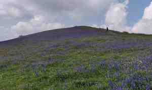
Proceed upwards along the track until you go through another gate out of the wood. Continue ahead taking the path up hill on to the Bury top.
Turn sharp left and follow the level perimeter path which has great views, turning right three times.
16
After the third turn follow the path for 200 yards and, at the end of the fence line, look for the way-marked stile post on the left-hand side.Turn sharp left onto the path which crosses two stiles before heading down quite steeply, via sets of steps and a further stile, to finally join a bridleway.
Here, you turn right and go downhill, joining a stony track to meet the road at Hydegate. Take the road opposite signposted to Cam.
After 90 yards, as the road bends to the left, you will see a facing field gate. (Here you have the option to take a permissive path, slightly along the road ahead on the left, to climb Downham Hill and enjoy the panoramic views, before returning along the same route to the field gate).
Go through the gate and continue with the hedge on your right to find a stile at the end of the field leading down onto a bridleway. (Alternatively, if it is very wet and the field is waterlogged, do not go through the gate but take the bridleway alongside to the right.).
Turn left and follow the bridleway until it meets a stony road. Turn right and, when the road turns right, continue ahead on the bridleway that rises gently along the side of Cam Long Down to a gate.
Through the gate continue ahead along the bridleway as it rises gradually to a junction of paths at the saddle between Cam Long Down and Cam Peak.
17
Take the path slightly left and uphill to reach the excellent viewpoint of Cam Peak.If you do not wish to risk the steep descent of the Peak beyond, (which is advisable on wet days), then retrace your steps for about 80 yards and take the first path, going sharply right, which descends gently around the hill through trees until you meet the steep path coming down the hill from your right. Here, re-join the route by turning left to cross the access road.
Otherwise, after enjoying the view, carefully descend the other side of the Peak, cross an access road and then follow the path through the trees to a gate to the road.
Turn left down the road for 70 yards and then left again through a kissing gate next to some stables. Cross two fields to a kissing gate to a road junction.
Go left along Drake Lane passing a school on your right, and after the last house turn left onto the footpath.
Follow this path as it turns right and then, after passing a house, turns again at a kissing gate to go down a series of steps to reach Chestal by the Bowls Club.
Continue ahead then bear left to walk up Long Street back to the Dursley Market House.
Enjoy your walk!
Why not join our Insiders and stay up to date with walking events around the Dursley area …
Join our Insiders
Get advance notification of
- walking events in and around Dursley
- early preview of festival programmes
- wait list access to booked out walks and more …
Pop your email address below and we’ll keep you in the loop
Your email address is handled in accordance with our Privacy Policy
